![How Can We Measure Climate Change? [Methods Explained]](https://www.impact-investing.eu/wp-content/uploads/2025/10/5173-how-can-we-measure-climate-change-methods-explained-1024x585.jpg)
Climate change is an urgent global challenge impacting ecosystems, economies, and our everyday lives. Did you know that the past decade has brought unprecedented increases in global temperatures and alarming shifts in weather patterns? Understanding how we measure climate change is crucial to address these pressing issues effectively. From satellite observations to ground-based assessments, various methods offer insight into the state of our planet and guide actionable solutions. As we delve into these measurement techniques, you’ll discover how they empower individuals, communities, and policymakers to make informed decisions tailored to foster resilience and sustainability. Join us on this exploration to uncover the essential tools we have to tackle climate change and create a healthier future for all.
How Scientists Measure Climate Change Over Time
Climate change is not merely an abstract concept; it is a measurable phenomenon that scientists have been tracking for decades to understand its impact on our planet. To gauge the extent of climate change, researchers employ a variety of methods that collectively provide a comprehensive picture of global warming. One of the foundational approaches is measuring the increase in global average temperatures over time, which is often tracked using historical climate data. This data allows scientists to compare current temperature readings with those from pre-industrial times, offering insights into how much warming has occurred.
Another crucial aspect is the assessment of greenhouse gas concentrations in the atmosphere. By analyzing air samples, researchers can quantify levels of carbon dioxide, methane, and other gases that contribute to the greenhouse effect. These measurements are complemented by other indicators, such as rising sea levels and changing land cover, which are crucial for understanding the broader impacts of climate change on ecosystems and human populations. Superior datasets like the one compiled by various climate dashboards help researchers observe these trends and correlations over time, highlighting the interconnectedness of atmospheric conditions and terrestrial changes [[2]].
Field observations are equally important; ground-based measurements from weather stations and ocean buoy networks allow for continuous monitoring of climate variables in specific regions. This data is particularly valuable for validating findings from climate models, which simulate future climate scenarios based on various greenhouse gas emission pathways. Understanding these models is vital, as they help predict the potential consequences of climate change and guide policymakers in effective response strategies [[1]].
In summary, scientists employ a range of methodologies to understand how climate change evolves over time. This multifaceted approach, combining historical data, atmospheric measurements, and sophisticated modeling, equips us with the knowledge needed to navigate future challenges posed by a rapidly changing climate. By continually refining these methods, we can enhance our understanding and response to climate change, ensuring a more sustainable future.
Key Tools and Technologies for Climate Measurement
To tackle the complex and pressing issue of climate change, scientists have developed a range of innovative tools and technologies that provide accurate and comprehensive measurements. These tools enable researchers to monitor changes in environmental conditions, analyze trends over time, and predict future scenarios, ensuring a well-rounded understanding of our planet’s climate dynamics. One of the most prominent technologies utilized today is satellite remote sensing, which allows scientists to collect data over vast areas and is particularly useful for monitoring atmospheric gases, sea surface temperatures, and deforestation.
Satellite Remote Sensing
Satellites orbiting Earth are equipped with sophisticated sensors that capture detailed data about the planet’s surface and atmosphere. For example, NASA’s MODIS (Moderate Resolution Imaging Spectroradiometer) can track vegetation cover changes, detect wildfires, and provide insights into land surface temperatures. These satellite observations are crucial for understanding spatial patterns of climate change, such as the melting of polar ice or the expansion of deserts, offering a holistic view of our planet’s shifting climate.
Ground-Based Observation Networks
In addition to satellites, ground-based observation networks play a pivotal role in climate measurement. Weather stations, ocean buoys, and research expeditions collect localized data on temperature, precipitation, and atmospheric conditions. This data serves as a validation tool for satellite-derived measurements. Organizations like the World Meteorological Organization (WMO) standardize these observations, ensuring that scientists across the globe use consistent methodologies to foster comparability and reliability in climate data.
- Long-Term Climate Monitoring: Instruments deployed at specific locations can track long-term climate changes, such as those observed in atmospheric carbon dioxide levels at the Mauna Loa Observatory in Hawaii.
- Data Integration: Climate data from various sources is integrated to provide a comprehensive overview of local and global climate trends, informing policymakers and stakeholders.
Innovative Data Collection Techniques
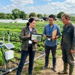
Emerging technologies, including drones and IoT (Internet of Things) sensors, are expanding the toolkit available for climate measurement. Drones can access hard-to-reach areas, collecting real-time data on vegetation and biodiversity, while IoT sensors offer continuous monitoring of environmental conditions at micro-scales, significantly enhancing data granularity. Such innovations not only improve the accuracy of climate models but also provide a rapid response to unusual climatic events, enabling timely interventions.
In essence, by harnessing these cutting-edge tools and technologies, scientists are better equipped to measure and understand climate change, allowing for more informed decision-making in addressing its widespread impacts. As climate data continues to evolve through these technological advancements, it offers hope for developing effective solutions to our global climate challenges.
Understanding Climate Models and Their Importance
Climate models serve as vital tools for scientists seeking to understand the complexities of climate change and its far-reaching impacts. By simulating the Earth’s climate system, these models analyze various interactions among the atmosphere, oceans, land surfaces, and ice. One compelling fact is that without these models, predicting climate trends and potential scenarios would be nearly impossible, leaving us ill-prepared to address the challenges ahead.
Models are categorized mainly into two types: Numerical Climate Models and Statistical Models. Numerical models use mathematical equations to simulate physical processes, allowing researchers to forecast how changes in greenhouse gas emissions will affect global temperatures. For instance, the Coupled Model Intercomparison Project (CMIP) has provided a framework for comparing different climate models and improving their accuracy. On the other hand, statistical models often analyze observed data to identify trends and correlations, offering insights into how past climate data can inform future predictions.
The Importance of Climate Models
The importance of climate models extends beyond mere predictions. They play a crucial role in policy-making by providing data-driven insights that inform mitigation and adaptation strategies. Governments and organizations rely on model projections to assess the risks associated with climate change, deciding on critical actions such as disaster preparedness and sustainable development initiatives. For example, countries in the South-West Pacific and Africa, as highlighted in WMO reports, are using model outputs to understand regional climate risks. This enables them to craft targeted responses to issues like extreme weather and rising sea levels, creating a blueprint for resilience in vulnerable regions [2] [3].
Moreover, climate models contribute to public awareness by translating complex scientific data into more understandable formats. As communities witness the growing impacts of climate change, such as record-breaking weather patterns and ecological shifts, climate models help to illustrate the “what ifs” of climate scenarios. This transparency facilitates informed discussions, empowering individuals and organizations to participate actively in climate action.
In summary, climate models are not just intricate mathematical constructions; they are essential instruments that shape our understanding of climate change and guide our strategic responses. Their ability to simulate various climate scenarios fosters informed decision-making, driving collective action towards a more sustainable future. Continued advancements in modeling technology will enhance our predictive capabilities and ensure we can effectively tackle the inevitable challenges posed by climate change.
Exploring Satellite Data in Climate Monitoring
Satellite technology has transformed the way scientists track and measure climate change, providing unparalleled data that informs our understanding of global warming and its effects on our planet. For instance, NASA’s Earth Observing System (EOS) includes a fleet of satellites that collect vast amounts of environmental data. These satellites monitor variables such as atmospheric temperature, greenhouse gas concentrations, sea level rise, and ice sheet changes. The ability to gather this data consistently and over broad geographic areas enables researchers to make crucial connections between human activities and environmental changes.
Key Contributions of Satellite Data
Satellites contribute significantly to climate monitoring through various means, including:
- Global Coverage: Satellites provide a comprehensive view of the Earth’s system, capturing information from remote and inaccessible regions, such as polar ice caps and dense forests.
- Long-term Data Collection: Continuous satellite data allows for trend analysis over time, crucial for understanding how climate change is developing. For example, the European Space Agency’s Sentinel missions are essential for monitoring land use changes and vegetation health.
- Real-Time Monitoring: Satellites enable real-time tracking of weather patterns, helping scientists predict extreme weather events linked to climate change. This capability is vital for disaster preparedness and response strategies.
Moreover, satellite data plays a crucial role in validating climate models. By providing empirical evidence of climatic changes and atmospheric conditions, satellites help refine the models that predict future climate scenarios. This relevance ensures that scientists can make more accurate forecasts about climate impacts, aiding policymakers in crafting targeted actions for mitigation and adaptation.
The integration of satellite data into climate monitoring gives us powerful tools for understanding the dynamic interactions within the Earth’s climate system. These insights not only enhance our scientific knowledge but also empower individuals, communities, and governments to take informed action against climate change, fostering a proactive approach to our environmental challenges. As satellite technology advances, it will undoubtedly continue to play a pivotal role in our quest to address and adapt to the realities of a changing climate.
The Role of Ground-Based Observations in Climate Change
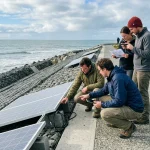
Ground-based observations have been foundational in our understanding of climate change, offering insights that complement satellite data. While satellites provide a broad overview of atmospheric conditions and environmental changes, ground-based measurements delve deep into localized variations, giving scientists a clearer picture of how climate change affects specific regions. For instance, local weather stations equipped with advanced sensors continuously monitor temperature, humidity, precipitation, and wind speeds. This data helps researchers assess the changes in weather patterns and their implications for ecosystems and human activities.
Importance of Ground-Based Measurements
Ground-based observations hold several advantages that make them indispensable for studying climate change:
- High Accuracy: Ground sensors are often more precise for localized measurements than satellite data, allowing for accurate readings of air quality and soil conditions.
- Direct Interaction with Ecosystems: Ground observations help scientists evaluate how climate change impacts specific habitats and biodiversity. For example, long-term studies of forest health and species migration patterns provide critical data on the resilience of ecosystems to changing climates.
- Support for Local Adaptation Strategies: By understanding local climate impacts, communities can develop tailored adaptation strategies. For instance, farmers can adjust planting schedules according to observed shifts in seasonal weather patterns, maximizing yield despite changing conditions.
The integration of ground-based data with satellite observations enriches our understanding of climate dynamics. Notably, the Global Climate Observing System emphasizes the synergy between ground and satellite data, stressing that while technology is advancing, the need for consistent and long-term ground measurements remains. Institutions like the National Oceanic and Atmospheric Administration (NOAA) and local meteorological agencies are crucial in maintaining these networks and ensuring data accuracy and reliability.
Practical steps can be taken to enhance ground-based climate monitoring. Citizens and local organizations can establish community-based weather stations or participate in citizen science projects, contributing valuable data to larger climate studies. For instance, data collected from these stations can be integrated into regional climate models, aiding policymakers in crafting informed responses to climate challenges. Emphasizing collaboration between scientific institutions and local communities empowers individuals to play an active role in climate observation, fostering a culture of awareness and proactive action against climate change.
Analyzing Ocean and Atmospheric Data Collection
To gauge the profound impacts of climate change, scientists rely on meticulous analyses of ocean and atmospheric data. The oceans are often referred to as the Earth’s climate regulators, absorbing approximately 93% of the excess heat generated by greenhouse gases. This immense capacity to store heat has significant implications for global temperatures, sea levels, and weather patterns. For instance, recent assessments indicate that the upper layers of the ocean have been accumulating heat at alarming rates, with a heat gain rate of approximately 0.66 to 0.74 watts per square meter over the last few decades [1]. Understanding these changes helps climatologists predict future climate conditions and prepare for the accompanying challenges.
Data collection in the oceans occurs through various means, including buoys, satellites, and research vessels. Buoys equipped with sensors measure crucial parameters like sea surface temperature, salinity, and wave heights in real time. Meanwhile, satellite technologies enable extensive coverage of the Earth’s oceans, delivering valuable data about sea surface temperatures and chlorophyll concentrations that indicate oceanic biological activity. Notably, oceanic data is complemented by atmospheric collections that monitor air temperature, humidity, and pressure at varying altitudes, forming a comprehensive understanding of the climate system. This synergetic relationship between ocean and atmospheric data is critical for validating climate models, which help scientists forecast potential climate scenarios and their impacts on weather extremes and ecosystems.
Moreover, the role of ocean and atmospheric data extends beyond mere observation; it forms the backbone of climate policy planning. Policymakers rely heavily on robust data collection and analysis to inform regulations and adaptation strategies. For instance, marine protected areas can be established based on data showing biodiversity hotspots affected by climate change. Communities also benefit from this information, enabling them to devise local strategies tailored to their specific climate risks. This integration of scientific data into local and global policies fosters informed decisions that seek to mitigate climate change impacts, demonstrating the profound importance of analyzing ocean and atmospheric data for a sustainable future.
The Impact of Climate Change on Ecosystems
Climate change is an urgent issue that profoundly affects ecosystems worldwide, with many species facing unprecedented challenges. For example, rising temperatures can disrupt the delicate balance of ecosystems, leading to shifts in species distribution. According to the Intergovernmental Panel on Climate Change (IPCC), species are migrating to higher altitudes and latitudes at alarming rates, as they seek cooler conditions. This migration not only impacts biodiversity but also alters the interactions between species, leading to a cascade of ecological consequences.
To understand the full impact of climate change on ecosystems, scientists use various measurement techniques, combining data from ground-based observations and satellite technologies. Ground monitoring stations track pivotal indicators such as temperature, precipitation patterns, and vegetation changes. For instance, researchers use remote sensing from satellites to observe changes in forest cover and the health of coral reefs, which are particularly vulnerable to warming waters and acidification. This dual approach provides a comprehensive view of how ecosystems are responding to climate stressors.
Furthermore, the effects of climate change are not uniform across ecosystems. Coral reefs, often referred to as the “rainforests of the sea,” are severely impacted by increased sea temperatures and acidification, leading to coral bleaching. Similarly, polar regions are experiencing rapid changes, resulting in the loss of habitat for species like polar bears and seals. The integration of diverse measurement methods, from in-situ sensors to satellite imagery, allows scientists to assess these impacts accurately and provide actionable data for conservation strategies.
In addressing these challenges, it is essential to take proactive measures. Ecosystem restoration projects and strategic conservation efforts can help mitigate some impacts of climate change. For instance, initiatives to restore mangrove forests not only provide habitat for wildlife but also enhance coastal resilience against storm surges and sea-level rise. Communities can engage in citizen science, contributing to data collection efforts, thus fostering awareness and promoting local action against climate change. These collaborative efforts can empower individuals and communities to protect vital ecosystems, ensuring their survival in a warming world.
Quantifying Greenhouse Gas Emissions Accurately
Accurately quantifying greenhouse gas emissions is critical in the fight against climate change, as these emissions are the primary drivers of global warming. Various sectors contribute to greenhouse gas emissions, including transportation, industry, and agriculture, each requiring specific methods for measurement. Understanding these methods is essential for policymakers and individuals alike, enabling informed decisions and promoting accountability.
To achieve accurate measurements of greenhouse gas emissions, scientists employ a range of tools and methodologies, including:
Direct Measurement Techniques
- Continuous Emission Monitoring Systems (CEMS): Installed in factories and power plants, these systems provide real-time data on emissions of gases like CO2, NOx, and SOx. By continuously capturing emissions data, CEMS helps in ensuring compliance with regulations.
- Remote Sensing: Satellites equipped with specialized sensors can detect greenhouse gas concentrations over large areas. For example, NASA’s OCO-2 satellite is designed to monitor atmospheric CO2 levels globally.
- Sampling and Laboratory Analysis: Collecting air samples from various locations allows scientists to analyze the concentration of greenhouse gases in a controlled environment. These samples can provide insights into sources and trends of emissions.
Emissions Inventories
Another widely used method involves the creation of emissions inventories, which account for greenhouse gas emissions from various activities across a specific region or sector. This approach includes the following steps:
- Data Collection: Gathering data from government reports, surveys, and industry databases to estimate emissions sources.
- Emission Factors: Utilizing standardized metrics, known as emission factors, which estimate the amount of greenhouse gas emissions produced per unit of activity (e.g., tons of CO2 emitted per mile driven).
- Calculating Totals: Summarizing the data to provide a comprehensive overview of emissions, which is essential for tracking progress toward climate targets.
This dual approach, combining direct measurement techniques and comprehensive inventories, enhances the reliability and accuracy of greenhouse gas emissions assessments. As countries commit to reducing their carbon footprints, understanding the methodologies behind emissions quantification helps in formulating effective policies and encourages businesses to adopt sustainable practices.
Moreover, innovations such as blockchain technology are shaking up the way emissions are tracked, ensuring transparency and improving accountability in carbon credit markets. By embracing these advanced methodologies, society can not only address current climate challenges but also work toward a sustainable future where emissions are effectively monitored and managed.
Innovative Methods for Climate Change Detection
Innovative approaches in climate change detection are shaping our understanding of the planet’s evolving climate system. Among the most promising developments are advanced data analytics, artificial intelligence (AI), and citizen science initiatives that harness community efforts to collect and analyze climate data. These innovative methods not only enhance the precision of climate monitoring but also empower individuals and local communities to participate actively in addressing climate challenges.
One notable advancement is the use of AI and machine learning algorithms to analyze vast amounts of climate data. These technologies can identify patterns and trends that would be nearly impossible for humans to discern in the massive datasets generated by satellites and ground stations. For instance, AI applications are being employed to predict extreme weather events by analyzing various climate variables, thereby allowing for more timely and accurate warnings that can save lives and property. By utilizing AI, researchers can also track changes in biodiversity and ecosystem health, providing critical information for conservation efforts.
Citizen Science: Harnessing Community Power
Citizen science projects, where everyday individuals contribute to scientific research, have gained momentum in climate monitoring. Platforms such as iNaturalist and ClimateWatch enable citizens to submit observations of weather patterns, plant phenology, and wildlife activity. This grassroots data collection not only enriches the scientific database but also fosters community awareness and engagement on climate issues. For example, projects like the “Globe At Night” initiative encourage individuals to record and report light pollution, which has implications for both human health and wildlife behavior. This data is invaluable for creating localized climate models and enhancing our overall understanding of climate dynamics.
Remote Sensing and Unmanned Aerial Vehicles (UAVs)
Additionally, remote sensing technologies, including satellite imaging and UAVs, are revolutionizing climate data collection. Satellites provide a global perspective on climate change, enabling scientists to monitor events such as deforestation, glacier melting, and urban heat islands. Meanwhile, UAVs, or drones, offer an agile and cost-effective way to gather high-resolution data in hard-to-reach areas. For instance, drones are being used to monitor changes in land use and vegetation cover, crucial for understanding carbon sinks and sources. Combining satellite data with on-the-ground drone surveys allows researchers to create more accurate and detailed models of climate-related changes.
By integrating these innovative methods into climate detection strategies, scientists are not only improving the accuracy of their measurements but are also making it possible to address global challenges collaboratively. Whether through cutting-edge technology or community involvement, the future of climate measurement is promising and vital for informed decision-making. These efforts are essential in the global fight against climate change, ultimately fostering a more sustainable and resilient world.
Challenges in Measuring Climate Change Effectively
Measuring climate change is an intricate endeavor faced with numerous challenges that can complicate our understanding of this global issue. One significant hurdle is the sheer complexity of the Earth’s climate system itself, which comprises interconnected components including the atmosphere, oceans, land surface, and ice masses. Each component interacts in dynamic ways, making it challenging to isolate the impact of human activities from natural variability. For instance, while greenhouse gas emissions contribute to rising global temperatures, other factors such as solar radiation and volcanic activity also influence climate patterns, making it difficult to draw definitive conclusions from raw data.
Another major issue is the variability in data collection methods and standards across different regions and time periods. While satellite technology offers extensive coverage, ground-based observations provide critical localized data that can sometimes be inconsistent due to differences in equipment calibration, measurement practices, and data reporting protocols. This inconsistency can lead to discrepancies in climate data, potentially skewing analyses. For example, temperature records from urban areas, which may be affected by the heat island effect, can be warmer than those from rural locations, complicating efforts to assess regional climate changes accurately.
Data Accessibility and Public Engagement
Access to quality climate data remains a significant challenge. Although there is an increasing amount of climate data available online, not all of it is easily accessible or understandable to the public and policymakers. The technical nature of climate data, combined with a lack of standardized formats, can pose barriers to effective communication and engagement. To overcome this, stakeholders must prioritize improving the clarity and usability of climate data, ensuring that it reaches a wider audience and facilitates informed decision-making.
Moreover, public engagement in climate monitoring can be both an asset and a challenge. While citizen science initiatives have successfully gathered valuable climate data, the reliability of this data can sometimes be questionable compared to rigorous scientific methods. Ensuring proper training and resources for citizen scientists is crucial for enhancing the quality of data collected. Consequently, integrating citizen observations with scientific efforts could provide a more comprehensive view of climate change impacts while promoting community involvement.
Addressing these challenges requires a multi-faceted approach, including investment in better technology, standardization of data collection practices, and fostering collaborations between scientists, stakeholders, and local communities. By embracing innovative solutions and leveraging diverse data sources, we can enhance our ability to monitor climate change effectively and make informed decisions to combat its impacts.
The Future of Climate Measurement Technology
The advent of innovative technologies is set to revolutionize how we measure climate change, providing unprecedented insights that can inform global policy and local decisions alike. One of the most promising advancements comes from satellite-based monitoring systems. These systems, which utilize remote sensing technologies, allow scientists to gather comprehensive data on atmospheric changes, land use, and ocean conditions at a global scale. For instance, satellites like NASA’s SMAP and ESA’s Sentinel-1 provide critical data not only on soil moisture and land surface temperatures but also on changes in vegetation patterns associated with climate stressors.
Emerging technologies in artificial intelligence (AI) and big data analytics are poised to transform climate measurement practices. By analyzing vast amounts of climate data from various sources-such as weather stations, satellites, and ocean buoys-AI can identify trends and predict future climate scenarios with more accuracy. This predictive capability is essential for both mitigating climate risks and adapting to ongoing environmental changes. Investing in AI-driven models can significantly enhance our understanding of climate dynamics, making it possible to make data-driven decisions that prioritize resilience in vulnerable ecosystems and communities.
Collaboration and Citizen Science
will also depend heavily on enhanced collaboration between scientists, policymakers, and the public. Engaging citizen scientists through mobile apps and online platforms can democratize data collection, enabling communities to contribute to climate monitoring efforts. Initiatives such as iNaturalist encourage people to document biodiversity changes in their local areas, providing valuable ground-level data that can complement satellite observations. As technology advances, platforms that facilitate citizen engagement will become increasingly sophisticated, offering tools for real-time data sharing and analysis.
Furthermore, the integration of blockchain technology promises to improve the transparency and reliability of climate data. By providing an immutable ledger for recording climate-related data, blockchain can help ensure data integrity throughout the collection process. This is particularly useful in establishing accountability for emissions reporting and climate commitments by corporations and nations. As these technologies evolve and integrate, they will provide a robust framework for understanding and addressing the complexities of climate change, allowing for timely and informed actions that can drive sustainable practices on a global scale.
Case Studies: Successful Climate Measurement Projects
One of the most compelling examples of successful climate measurement projects is the Climate TRACE initiative, which utilizes advanced technology to track greenhouse gas emissions globally. By harnessing satellite imagery, remote sensing, and machine learning, Climate TRACE provides unprecedented detail about emissions sources and their impact on the environment. This transparency is crucial for policymakers and businesses aiming to meet climate targets. The data collected allows stakeholders to make informed decisions, effectively hold each other accountable, and inspire immediate climate action based on accurate emissions tracking.
Another noteworthy project is NASA’s Earth Observing System Data and Information System (EOSDIS), which collects data from various satellites. It offers a comprehensive view of land, atmosphere, and ocean interactions, making it a vital resource for researchers and environmental managers. For instance, EOSDIS supports critical assessments of climate change by providing long-term datasets related to temperature increases, sea-level rise, and the impacts of extreme weather events on ecosystems and human populations.
Local initiatives also play a significant role in climate measurement. In the United States, the City of San Diego has implemented a robust climate monitoring system that includes ground-based sensors to measure air quality and urban heat islands. By integrating real-time data collection with public accessibility, San Diego empowers residents to engage with their environment actively. This approach not only promotes community involvement but also aids local government in tailoring climate policies that directly address the unique challenges faced by the urban population.
In summary, successful case studies in climate measurement demonstrate the power of technology and community engagement. From global satellite initiatives to localized sensors, these projects highlight that comprehensive data collection and public involvement are critical components in combating climate change effectively. By showcasing various methods and their outcomes, these examples inspire other regions and countries to adopt similar strategies in their climate action plans.
Frequently Asked Questions
Q: How is climate change monitored around the world?
A: Climate change is monitored globally through a combination of satellite data, ground-based observations, and oceanic measurements. Each method provides insights into temperature changes, ice melt, and greenhouse gas emissions, helping scientists track shifts in climate patterns over time.
Q: Why are satellites important for measuring climate change?
A: Satellites play a crucial role in climate change measurement by providing comprehensive, real-time data on atmospheric conditions, land use, and ocean temperatures. They enable the monitoring of large-scale changes that ground observations alone cannot capture, enhancing our understanding of global climate dynamics.
Q: What are the key indicators of climate change?
A: Key indicators of climate change include rising global temperatures, shrinking ice sheets, increasing sea levels, and higher concentrations of greenhouse gases. These indicators help scientists assess the ongoing impacts of climate change across ecosystems and human societies.
Q: How do climate models predict future changes?
A: Climate models predict future changes by simulating the Earth’s climate systems and incorporating variables like greenhouse gas emissions, solar radiation, and ocean currents. These models are essential for understanding potential climate scenarios and informing policy decisions.
Q: What technologies are used to measure greenhouse gas emissions?
A: Technologies like gas analyzers, satellite sensors, and ground monitoring stations are used to measure greenhouse gas emissions. These tools provide precise data on emission levels, which is vital for tracking progress in reducing greenhouse gases and implementing effective climate policies.
Q: How can local communities measure climate change effects?
A: Local communities can measure climate change effects through community-based monitoring initiatives that track temperature changes, plant phenology, and local weather patterns. Engaging citizens in data collection can empower them to take action on climate change while fostering awareness and education.
Q: What challenges exist in measuring climate change accurately?
A: Challenges in accurately measuring climate change include data collection inconsistencies, technological limitations, and the need for comprehensive long-term datasets. Additionally, natural variability in climate patterns can complicate the assessment of human impacts on climate.
Q: What role does citizen science play in climate measurement?
A: Citizen science enhances climate measurement by involving individuals in data collection and analysis. This grassroots approach can expand monitoring networks, increase data availability, and raise public awareness about climate change issues, leading to informed community actions.
For more insights, check sections on “Key Tools and Technologies for Climate Measurement” or “Innovative Methods for Climate Change Detection” in the main article.
Closing Remarks
As we explore the crucial topic of measuring climate change, remember that these methods not only quantify our impact but also empower us to drive more effective action. Understanding how we measure climate change is the first step towards advocating for stronger policies and engaging with initiatives like Climate Action 100+ and Collaborative Sovereign Engagement on Climate Change. If you’re eager to play your part, check out our in-depth guides on sustainable investment strategies and the importance of public engagement in climate action.
Don’t let your journey end here-subscribe to our newsletter for more insights or dive into our resources that tackle real-world solutions to environmental challenges. Every small step you take contributes to a larger collective effort. Together, we can bridge the gap between knowledge and action. Share your thoughts in the comments and don’t hesitate to reach out with questions; your voice adds value to this vital conversation.
Get our latest guides, news, and insights highlighted in your Google Search & AI Overviews.